Translate

Saturday, December 21, 2013

Report #10 - Dec 12 to Dec 21, 2013 - Northern Exuma Cays to Exuma Cays Land & S

Report #10 - Dec 12 to Dec 21, 2013 - Northern Exuma Cays to Exuma Cays Land & Sea Park

Before we left Nassau Dec 12 we stopped at BASRA - Bahamas Air-Sea Rescue Association - and bought 2 baseball caps and made a donation. The Bahamas is a vast island nation and while there is the Bahamian Defense Force with about 26 various boats from 25' whalers to the 2 150' frigates and two aircraft, there is no coast guard. BASRA is a volunteer association made up of boats and private planes owned by private individuals in the various island chains and Cays linked primarily by VHF radio & SSB radio. This is the organization that is primarily involved in rescue operations. The Nassau office is the main office and is staffed again by volunteers. Visiting boaters should stop b(u)y (and donate) and support this volunteer organization when in Nassau, Freeport or Georgetown where their 3 offices are. Hopefully you never speak to them again but every day calls come in for help.

We made the 42 NM from Nassau to Allen's Cay Harbour handily and it was a perfect day for crossing the Grand Bahama Banks. The wind was very much on the nose, of course, and the winds that day were low - 5-8 knots and sunny. We crossed the Yellow Bank rather than going south and then east to the White Bank and so we had some coral heads to watch for. We timed the crossing of the Yellow Bank for after 11am when the sun is higher and the glint on the water (we were heading south-east) is mostly gone. That lets you see the coral heads so you stay floating and don't become an insurance statistic. The water was just beautiful and crystal clear and the coral heads are easy to spot - black on light blue, and easily distinguished from the sea grass which is lighter and more of a muddy green. Safely through that band of the banks, we gave Otto the helm and went for a nap. Well, the combination of the sun, the gentle rocking and the coral free balance of the run put Blair to sleep while Otto was on duty. Edi just shakes her head.

We pulled into Allen's Cay mid-afternoon and arrived to quite the scene - the anchorage was empty, had it all to ourselves. There is an anchorage area surrounded by cays - Allen's Cay to the west, Leaf Cay to the east and SW Allen's Cay to the south and in the middle is Allen's Cay "harbour." We anchored, dropped the dinghy, put on our snorkel gear and dove in. Four large fish were under the hull - remember this water is crystal clear, and they were about 3 feet and one swam right at us and then we noticed a big brown fella. Right. Back on the boat, fully refreshed and very awake. Well later we figured out the fish were remora type fish eating the algae on the hull. These guys work like a city work crew, three lying on the bottom watching one guy munching. The brown guy? Bull shark. He didn't stick around and we were back snorkeling. 

A boat came in late and the mysterious magnetism of anchoring did its magic and they anchored 75 feet from us - did I mention this is a very large anchorage? The wind whipped up, our day of calm over, and the other boat dragged back and forth and by 11pm they had move much further away so they could let out more chain. We were able to get to sleep and by mid-morning they were gone and we had the entire neighbourhood to ourselves for the next day and a half.

The big attraction at Allen's Cay is the rock iguanas, basically prehistoric critters. They are native to the Bahamas, and are critically endangered. Handsome devils aren't they? When you land - and they are on Leaf and SW Allen's and Allen's they come out onto the beach and wait to see what happens. The tour operators have been feeding them, it's the draw for their excursions from Nassau so the tourists have to see them. Iggy may be prehistoric but he isn't stupid. So, when a dinghy arrives they all come waddling out and wait to see if there will be food. They are vegetarians but they have teeth. Our big entertainment was rooting for team iggy to get in a bite in when the tourists teased them.


A weather window opened, and four more boats arrived and we split for the next cay south, Highbourne Cay. It is a privately owned island with a marina and a few residences. We stayed a night and then made the push a little further on to Norman's Cay. These cays are just miles apart and skipping a few made Norman's only 2-3 hours sail away. We anchored on the west coast just below Skipjack Point with a few other boats, accessed by a very narrow channel with sandbars and coral heads all over. The winds were forecast to whip up big for the next week - 20-25Knots, and this anchorage provides a nice shelter in the lee of the Cay.


Norman's Cay was infamous in the early 80s as part of the Columbian drug smuggling and Norman's Cay is the island airport in the movie Blow (Sean Penn and Matt Damon) the little island runway the spot for planes coming in from Columbia. There is a plane wreck from those days when one pilot on a run clipped the wing and end of story. The local fish must have been stoned for a while. None of that now, the cay is very slow moving and there is no marina, no store, and the local restaurant, Macduff's has been sold and the new owner hopes to be open by early January. Great dinghy rides and beaches and entertaining small passenger planes here and there.


We decided since the weather was not going to change for a week, we'd make a push to get to the Exuma Cays Land and Sea Park and so one day Edi (well, it might have been Blair) had the swell idea to go for a sail on the Sound since the wind tucked nicely on the bank side of the Cay behind 40ft hills was down to 12-15 knots and obviously Chris Parker was a little off his weather forecasting game. So off we went through the cut onto the sound and we can report the little notations in the charts that say the cut can be rough when easterlies oppose tide are based on reality. OK, no problem, it's just a matter of thousands of miles of Atlantic Ocean piling up from 5000+++ feet depth to 15 feet in about 500 yards. Well, the waves calmed a bit once we got out to the deep water and we had a great push in 20-25 knots and 6-8 foot seas to Warderick Wells Cay. The boat is strong and we love her. We arrived about 4:30 pm having reserved a mooring ball that morning.
 

The Park is 22 miles long and about 8 miles wide incorporating a dozen major cays and countless smaller ones. The rules are simple, take nothing and leave nothing. No fishing, no conching, no fires, no trash, no water available, this area is pristine and the marine life thrives and the coral reefs are incredible. The Park is all about letting nature develop without human interference and setting up interaction areas where we can look and not harm land and sea life. The Park was set up in the late 1950s / 1960s and is funded by the Bahamian National Trust, so it was established by government legislation but is funded by private donations and user fees. The Park is run out of Warderick Wells where the Ranger station is location - there is also a small Defence Force detachment with a 30' cruiser.

 Cherry (wo)mans the radios and takes the bookings answers questions and handles the monies. She is also organizing Christmas dinner - turkey and ham - and is organizing the pot lucks from the boats to supply the side dishes and desserts. Dinner will be 1pm at the Rangers' Residence and all boaters are welcome.

The ball is costing us $15/day and for that we get a mooring ball and possible the most incredible anchorage there is. The mooring is in a channel that is very tidal so there is a very swift current and the mooring balls are in a curving line following a deeper line with VERY shallow areas on both sides. Check it out on Google Earth. This is the type of situation where if there was no mooring ball we would use a Bahamian anchor - 2 anchors at 180 degrees with the boat in the middle. So as the tide reverses and the current reverses, the boat stays centred in the very narrow channel.


On entering the mooring a crew jumped into their dinghy having seen our mainsail still partly up and thought we might have engine problems and they came out to help guide us in and got our line onto the mooring ball's pendent for us - very nice landing after an interesting sail and coming into a very narrow, shallow and swift current. These folks were from Baha au Rhum, a 48' Fontaine Pajot. Eric is the captain, the owner and he being friends and Eric is running a charter business for the season on this Cat. He is in the middle of a shakedown cruise and has friends Daniel & Genvieve, Julie (all early 30s to later 40s) and Julie's son Louric (about age 10) aboard for about 2 weeks. It was Eric and Dan in the dinghy and a little while later Dan and Gen realizing we were very much in need of a cold beer coming back with supplies. We after dropping the dinghy, packing away the mainsail and silencing all the running rigging for the night, we tidied ourselves up, splashed on some Aqua velva (well Blair did) and assembled cold beers and shooter material. We broke out a bottle of Don Julio Tequila, farewell gift of Mike and Beck on Harvest Moon, and headed over. Well, the tequila and lemons were a hit and Gen showed us how. Great people, from Montreal of course, and great conversation. Gen and Dan, get a boat and get out here, you are cruisers at heart. DO IT NOW!! Eric, email us, we look forward to seeing you on your runs from Georgetown to Nassau and back. Anyone looking for a winter holiday - email us and we'll put you in touch, great boat, great captain and great cruising grounds.

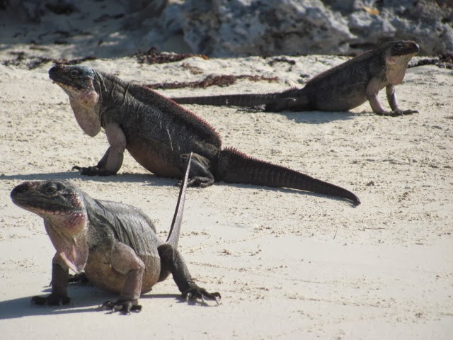
Warderick Wells Cay has many walking paths and reef dive areas. The walking rules are stick to the paths, look and do not touch, leave nothing, take nothing. Sounds easy but you see interesting things all around, a conch on the beach left with the receding tide, hermit crabs dragging their shells, little curly lizards (OK, less of an urge to pick up but they are fearless and very cute), mangrove leaves, shells etc. The Rangers are supported by a group of volunteers from near and far and the walking trails incorporate signage with descriptions and information all set in and among wonderful vistas. There are trails linking all the beaches, anchorages and the Ranger stations and so we can walk for hours and visitors can also dinghy around to remote beaches and farther walking trails. The Cay is almost a desert island with life struggling to take hold with very little fresh water. W.W. has Loyalist ruins dating from 1780s as well. Other Cays north and south of W.W. have other ruins, wrecks and coral reefs to dive and snorkel and trails to explore.
We walked up to Boo-Boo Hill yesterday overlooking the Sound where we came down from Norman's Cay, with the ocean crashing into the Cay, and with the Blow Holes (water comes shooting up.) Boo-Boo is named for the haunting calls of the crews of three boats wrecked and lost on the rocky shore and a few survivors remains found on the island - we are glad Halloween is long past!

At the top of Boo-Boo Hill, cruisers carve, paint and ink their names on wood. There is a double feeling to the place - elation in the new contributions bright and sharp atop the wistful funereal mound of faded, bleached and wind smoothed mound of older placards. Hopes, dreams and achievements, those recently recorded and those preceding, wistfully reaching out to us here and now. We looked but did not find any older names we hoped to see - the oldest dates seemed about 2006-8 before the wood had completed smoothed and the paints totally faded.


We made our contribution and deposited the transitory evidence of our presence, knowing the trade winds, the sun, the salt water all would slowly remove too our record of passage. It was comforting to think that there is hope for Ma Nature yet, that places remain where we have not permanently screwed it all up, where human presence has not devastated completely nature. That is what the Park is all about, of course, allowing land and marine life of all kinds a chance to survive humanity's onslaught.


The dive and snorkel sites do much the same for experiencing marine life. The park has located mooring balls on certain coral heads near reefs so the dinghies can tie up without dropping an anchor into the area of corals (anchor strikes on coral are devastating and take decades to repair.) The marine life is teaming here as the 176 square miles of the Park are a no fishing, no conching, no netting etc. zone. Bahamians say marine life here is sort of what all the Bahamas were 50 years ago. Like Atlantic Canada's fisheries, the Bahamian fisheries have been devastated and the Park is a zone of nurseries. There are a dozen or so dive and snorkels sites in easy dinghy distance from the mooring and we look forward to exploring those (we have wet suites and snorkles gear.) Our fishing gear and Hawaiian spear sling stay on the boat until we get the Staniel Cay at least.

We are staying here until December 26-27, so for a full week. We have been travelling steadily, provision, fueling etc and this is an absolutely wonderful place to take a holiday and some time off. The tradewinds are blowing steadily since we left Highbourne Cay, and today again are blowing 18-25 knots. Our crew has grown and we are doing what we always laughed at - naming and adding to our crew. In addition to Otto, our helmsman, we have Mr. Archie Jiggles, our lookout on the port spreader, Ginny the wind generator, queen of power generation and overseer of the silent solar quartet. Ginny is happily earning her keep along with her cousins on other boats. Rocky, the rocna anchor, has faithfully kept us all in place through some major blows. Sparky, our radio operator - the ssb ICOM 802 radio - keeps us in touch with Chris and the weather and home and friends via the Pactor 3 modem. All of us living and kept safe and sound and secure in the strong embrace of our floating home Kind of Magic. I've got to lose weight, it's getting a bit crowded! If a 6' pink talking rabbit joins us, we'll seek help, promise.

We've had lots of sun too, the boat is coated in salt water from our sail on the Sound a couple of days ago. We are coated from the stakpak down, including the dodger and cockpit enclosure (the side curtains mostly kept us dry on that sail) and of course the deck and hatch covers. It doesn't really dry and is quite sticky, so the rare rainfall is very welcome. Aquaman (childhood fav along with Spidey) the watermaker has got into his groove and efficiently and quietly makes water from water at the rate of 3 gallons an hour. The goals of surviving on less, producing no garbage footprints, burning as little diesel as possible etc. are very much necessities of long-term living out here. There are no garbage dumps, no water or diesel available. Everything from food packaging, to cans, bottles, holding tank contents, toilet paper etc. needs to be minimized and taken out for proper disposal. We burned our burnable garbage on a remote area of the beach at Norman's Cay, with our camp shovel and bucket used to bury the ashes off beach. We pumped out 5-6 miles out into the Sound in deep water and our metals and plastics are crushed awaiting a recycle site in Georgetown.
 
As we settle in and get our LED Christmas lights set up, scrounge for presents for the Warden and staff and for a couple of kids on the surrounding boats, our thoughts are very much of home and those we haven't seen in a long time, some for far too long a time. We love you, we miss you and we wish very much for your happiness.

Merry Christmas, Happy Hannukah, Seasons greetings all:
Tata-Joseph & Diane, Dad-Harry & Ruth, Mark & Matthew & Andrew & Steph & Sue, Brian & Susan, Kerry & Brad, Diane, Kimberly & Alex, Paul & Amber, Sheila & Peter, Ryan & David & Laura & Tracy, Daniela & Slobodan, Elizabeth & Jusof & Donny, Scott & Nicole, Denise & Phil, Graham

Lots of hugs and kisses and best wishes for everything you have asked mommy and daddy and santa for:
Amy, Megan, Hannah, Thomas, Charlie, Grace & her soon to arrive sister, Petra, Leon, Mackenzie, Oliver;
Auntie Edi and Uncle Blair love you and miss you

To Homer & Kerry & Emerson & Emmet, Ross and Bev and their whole crew: Rhonda & Ava & Brenda & Dan & Ally & her soon to arrive sibling & Paul & Leeanne & Mary & Doug, Heidi and the gals at the Queens, the gals at the Lockeroom, to our supporters and friends at our old sailing Club Hawkestone Y.C., to friends and fellow dreamers and travellers all, well-wishers and cousins, near and far;

Finally and especially, to our fellow cruisers and travellers of the watery road, best of the season to all, we'll listen on the airwaves and scan the anchorages for you, keep safe and securely anchored

MERRY CHRISTMAS, JOYEUX NOEL, HAPPY HANNUKAH, SEASONS GREETINGS
From the crew of Kind of Magic - Captain Edi, Gopher Blair, Otto, Archie, Ginny, Rocky & Sparky

Mooring ball #11, North anchorage, Warderick Wells Cay, Exumas, Bahamas
2545.4 NM / 2927.2 STM / 4683.7 KM - 4 ½ months out
Blair & Edi

Tuesday, December 10, 2013

Report #9 - Dec 3 - Dec 10, 2013 - Chub Cay to Nassau


Report #9 - Dec 3 - Dec 10, 2013 - Chub Cay to Nassau

We only stayed for a day in Frazer’s Hog in the Berrys as the winds were picking up and for the next week or 2.  We listen every morning on the SSB radio at 6:30am to God – aka Chris Parker – who tells us all when we can come and when we can go and for how long and how we shall get there.  Chris is a climatologist who lives in Florida aboard Bellamy, a very nice motor yacht.  Chris broadcasts between 6am and 9:30 am on various frequencies across the HF bands.  He is available to listen to by anyone with an HF radio but he also makes a living from this so cruisers sign up – some do anyhow – and pay a fee of $200 per year for weather info and these “sponsoring boats” can speak to him daily and get specific information.  He also offers an email up date for the Bahamas, the East Carib and the West Carib for another $100 a year which we also got and we receive it by email on our Pactor 3 modem also over the SSB radio.  Since weather is THE factor the price is great and Chris is one hard working guy, 6 days a week.  He updates his daily forecast by the email service and he also clears urgent traffic, emergencies and co-ordinates lost boat searches ie., a cruiser left for the Abacos at the beginning of December and had not been heard from for a week.  Boats look out for other boats and Chris is such a central character that this is another benefit of the weather net.  There are other “nets” and we’ll talk about them at some point.

Cruisers from Charleston to Florida, from the Bahamas to Trinidad, from Texas to Guatemala, all tune in to hear the good news.  Lately, Chris tells us that there is more bad news than good which is retarding much progress south and to the promised lands.  The Christmas winds have arrived early and that means high trade winds from the East.  One boat got to Luperon in the Dominican Republic and wants to get to Puerto Rico and Chris said it may be January before the winds let up enough.  However, we are a bit north and the winds are not so bad and we seized a decent window and are fortunate to be in the Bahamas. 

So, you now have an idea why our Berry Islands stay of several days changed to an overnight.  Chris forecast the winds would build by later afternoon to 15-20 knots from the east and east-south-east to change it up a bit and that would only build to 25 knots steady for the following week.  Since that was our heading we decided to run to Nassau before the seas grew too much.  Dec 4 we left and we beat hard on an ESE that became increasingly “interesting” into the later afternoon.  We were glad to make Nassau in 5+ ft waves and a nauseating frequency, our progress so slow we were fortunate to have the last twilight to set our anchor.

Clearance granted (thank heavens!) from Nassau Harbour Control, we anchored between the King George cruise ship docks and the Paradise Island bridges in about 10 feet.  


 The anchorage is rolly and there is a good current that runs between the east and west entrances.  We have been quite surprised at how few boats (only about 6-8) there are here but it is both early in the season and the weather has been brutal. 


We visited Atlantis, docking the dinghy at the Atlantis Marina dinghy dock, no charge, and walked around but found most of the areas are only open to guests and to those willing to pay $30 a day to access the grounds (other exhibits are extra!)  


The place is huge and there is a local basketball league that plays on a court in a conference /meeting room – the place has many such rooms, did we mention this place is huge?  We decided we needed the $ more than King Neptune so we retreated to the other side of the harbour with the unwashed masses.    


We dinghy to shore at least once a day, doing laundry at a marina, shopping, we have filled diesel and gas (((we have shifted 2 of our 4 diesel jerry cans to gasoline for the outboard now for a total of 4 jerry cans of gasoline, 2 of diesel), and have walked and walked.   The cruise ships come and go and the rhythm of the harbour revolves around them and the Atlantis resort.  The glass bottom boats, snorkelling boats, party boats, parasail boats, and dive boats whiz back and forth starting at about 8am until dark and then there are just a few party boats with music drifting until about midnight. 


There are also the fishing boats, work boats, island freighters, ferries, passenger island ferries and the Mail Boat all making their journeys at all times of day and night.  Great entertainment and the holding has been great, no dragging at all.


We have been here long enough that a number of the boats wave at us and the guys on the conch boat anchored in front of us chat with us and have invited us to go conch diving with them.  That's them in the three boats.  The harvest the conch, get the meat and sell to the restaurants and the shells go to the bottom for a couple of days and then they bring them up (now minus the last bits of the meat) and dress them up for sale to the tourists.  The guys at the pirate bar where we get the wifi know our beer (Sands and Sands Lite.) 


The conch seller in the little skiff at the downtown wharf greets us and always helps Edi in or out of the dinghy and the conch salad guy at Casablanca Bar waves – that’s him beside Edi. 


We have met some Canadian expats living and working here at the Poop Deck, sort of the local boating bar-restaurant who have given some info and local knowledge – yes they always lock the dinghy.

Shopping has been an experience.  Basically prices run from the same as home (all dairy products including milk, eggs, cheeses but for some reason not yogurt; some canned foods are also the same), to 25-50% more like red meats and a lot of canned items and pastas to 100-200% more like all paper products (12 pops for $8, 1 roll TP $1.89, 1 box Kleenex $6.09 etc.)  Our 120 rolls of TP, 50 boxes of Kleenex and 30 rolls of paper towels that brought some jokes are turning out to be our best investment ever – maybe we should open a store and fund the cruising kitty, smuggling paper products from Miami!  With these prices, we had a great surprise when we went to the local Dominos Pizza down from the grocery store and got the special – 1 large, 1 medium and a half-rack of ribs for $25?!?  Forget shopping, we can go there every 3 days!  The Dairy Queen next door was double the price from home.

The weather has been outstanding – 28 degrees C daytime and dropping by early am to about 22 and today we had the first rain since around Vero Beach.  While it only lasted 30 minutes, it got the deck wet enough to give it a scrub with a salt water rinse.  Liquid soaps (not bar soap) will lather in saltwater but not nearly as well. 

In filling the diesel and gas we also looked for water and found only $1 a gallon water – no, not Perrier from France!  At Chub Cay the price was $0.55 / gal.  Prices may be slightly less at marinas but all water here is made by desalination and there is not much free anywhere so we decided to commission our watermaker.  We have a Katadyn PUR 80 and we were going to wait until the Exumas but the harbour water is quite clean, being changed over constantly by the tidal flow.  We didn’t make water in the US since we always had a free source of potable water.  So, now we make water out of water, making 12 gallons yesterday.  Amperage draw has been quite above specs but then we found online a note on one model stating that there is a breakin period where the amperage draw will be higher for the first 20 hours or so.  The amperage draw for the first hour was over 16 amps (spec is 8) but by hour 3 it was down to 12 amps.  We purchased the watermaker on a great sale 5 years ago and it has been installed but never used.  I have greased the piston with dialectric silicone compound per maintenance instructions and it seems to be helping grease the seals and loosen up the piston action.  Water quality is excellent with no taste at all which surprised us but at less than 100 ppm (we have a digital analyzer and potable is less than 1500 ppm and the Miami water we got is 335 ppm) we are happy.  We are also making about 3 US gallons per hour, within 10% of specs in high salinity water so it is just the amperage issue which seems to be halfway to specs now and improving as the unit breaks in.  Yay, fewer jerry cans to lug – and water is about 10 lbs a gallon.  We just need to figure out have to turn on the beer output lever.

Life is quite comfortable in Nassau and we have a well-set anchor, the lie of the land, the dinghy dock locations, the cheap bars with free wifi and the locals’ grocery store.  Must be time to leave.

We spoke to Chris this morning and he said the day after tomorrow should be a good day to jump to the northern Exumas so we are in departure mode getting the boat set, the garbage rounded up and listing the last items to buy (perishable foods.)  And we must say goodbye to the gang at the Pirate’s Pub and the Poop Deck and Casablanca and…  Maybe a Thursday departure is a little ambitious.

s/v Kind of Magic @ anchor, Nassau Harbour, New Providence, Bahamas
2475.4 NM / 2846.8 STM / 4554.8 KM travelled
Tuesday December 10, 2013, 4 months out
B & E out                                                             

Tuesday, December 3, 2013

Report #8 - Nov 19 to Dec 3, 2013 - Florida to Gulf Stream Crossing

Report #8 - Nov 19 to Dec 3, 2013 - Florida to Gulf Stream Crossing

We left St. Augustine and stayed the first 2 nights on the hook on the ICW at convenient anchorage points when a front hit us north of Vero Beach. There are some sections of the ICW which are very wide and open allowing the winds to whip up the waves. We were hit with winds gusting to over 30 knots and some very heavy fog and heavy driving rain during which we were using binoculars and the chart plotter and radar going from one buoy to the next. At least the big sport fishers were slowing down for a change!

This front was forecast to continue for a number of days and so we decided to tuck into Stuart. This city is on the St. Lucie River which connects the Atlantic ICW to Lake Okeechobee and to the west Gulf coast ICW (which runs all along the Gulf Coast to Texas.) Stuart is about 7 miles up the St Lucie River so it is a bit off the "highway" but for a staging town it was fantastic.


Under the 65 ft fixed, through the usually open railway bridge and the blue one just  behind the railway bridge is Old Dixie Hwy bridge.


We stayed on a mooring ball at $20/nt at the Sunset Bay Marina and the balls are only $300 on a monthly, just over from Marty and Lisa on True Colors who we had met in Annapolis. This marina is beyond great - very clean facilities with cruisers' lounge with TV, showers and laundry, a complimentary bus on Tuesdays and Fridays to shopping, free bicycles to borrow, free wifi (not much bandwidth but still…) and large dinghy dock all a short walk to the scenic "old town" a street with nice shops and restaurants.


We stayed for 5 days and rode the bikes about 10 miles a day (JC Penney's at the mall, Target, Lowes & Home Depot, West Marine, banking), walked the 5 blocks to the Publix grocery store, used the marina bus for bulky purchases etc. We provisioned and filled in all the items on our list including fishing gear (rods, net, gaff, tackles etc - we are ready for you Joseph!) We also picked up our VHF radio at the West Marine where we had Raymarine ship it to. The radio works like new and we get good reception over 40 miles.


We left on Thanksgiving Day (US version) so we missed the dinner put on by the marina (free, boy these folks make it very hard to leave.) Back on the road we anchored on the ICW 2 nights (Lantana bridge and Lake Sylvia in Fort Lauderdale) before arriving in Miami. We anchored on the north side of the Venetian Causeway right off Miami Beach where the Marine police unit has a detachment and there is a boat launch with water at mile 1088.5. This was a very convenient spot and just on the south side of the Miami Beach and the Venetian Causeway is the Collins canal which runs miles. Just up the canal a mile or so is Publix Grocery store which has put in a small dinghy dock with locking rings and a gate right across the street. We picked up our last items for provisioning (found a little more room for beer, munchies, stocked up on fresh fruits and veg and some final meats) and started getting the boat ready for crossing. "Valero" gas station is just a little further up the canal from Publix, about another mile or two. It sells diesel so we took our jerry cans and topped off both our diesel and our gasoline. There is a small ladder and the canal wall was a bit overgrown but we were on a mission and we climbed up and over. The owner saw us and came over and unlocked the small gate and when we were ready to leave he had swept the steps and the wall area around the ladder and apologized for it being messy! We chatted a bit and found out he is Cuban and came to Miami 40 years ago with the Cuban exodus. Back to the boat with ice creams also from the gas station.  

We began listening to the weather carefully for crossing the gulf stream from Florida to the Bahamas starting in Stuart. Chris Parker is a weather forecaster and makes a living providing weather services to cruisers from the US eastern coast from about Charleston to the Bahamas and the Caribbean. He broadcasts every morning on ham radio and people throughout this region and even into the Atlantic for crossings listen to him. He starts broadcasting at 6 am and finishes at about 9:30 with 4 broadcasts on different frequencies. We began looking for our "weather window." We seized an opportunity on December 2 and left our anchorage at 8 am and spoke to incoming Sea Change (Shane, Mary and Franklin who we'd first met in Charleston and again in St. Augustine.) Out we went past the cruise ships, tugs, commercial traffic and ferries and we were clear and out the Government Cut Inlet by 9:45 am.


Ever wonder how things get to islands?  Those aren't Tonka toys!

Less than an hour later we were in the Gulf Stream, a body of water that runs in the Oceans like a river. The Atlantic water is a deep jewelled blue, so beautiful after the murky and opaque waters of the inland US. The gulf stream runs northward between Florida and the Bahamas and is about 3-5 miles off the US coast and is very roughly 30 miles wide. The stream has a northward current of 1.5 to 3 knots so slower boats like us have to take that into account and head more southward of the point where we want to arrive. We crossed the gulf in about 15 knots gusting to 20 with 4-6 foot seas and winds from the west. That put the seas and wind almost behind us, not the best angle and not the most comfortable but good enough to make it across and way better that it had been for 2 week and probably better that it would be for another week. We were in the Bahamas and just passing Bimini to the south of us at 6pm having motor-sailed for 8 hours covering 45 NM by the time night fell after a truly fantastic sunset that lit up the clouds and ocean and turned all the blue above and beneath us into pinks and roses and oranges. It was surreal watching the burning sunset with us and Kind of Magic's sails bathed in the glow.


The night was moonless but the stars came out in full force and were magnificent. Our course turned a little bit to the south and the wind moved a little bit north and that added up to turning off the engine and putting the full sails out and sailing a beam reach for about another 60 miles in 12- 16 knots, good for just over 6 knots speed. From Bimini on the North West Channel we were on the Great Bahamas Bank and in as little as 12 feet of water all night long. Behind us the water had been up to 3000 feet deep and in less than ½ mile we had entered this vast shallow region. In the dark we sailed along listening to Mike Oldfield albums, cranking up Tubular Bells, and trying not to think of lurking coral heads (the Banks are safe and virtually coral head-free but still in the middle of the night…) We passed some big yachts in the night, some showing on the AIS and radar, but for the most part we were alone on the Banks. We pushed on through the North West Channel which opens from the Banks into the "Tongue of the Ocean" and watched in amazement as the depth dropped from 15 feet to 1500 feet and more in 500 yards. Dawn came and we were on course for Chub Cay, at the very south end of the Berry Islands. We arrived at 7:30 am and had covered 124.5 Nautical Miles (NM) in about 21 hours. We hoisted the Yellow "Q" Flag(for quarantine - a customs not disease thing!)while we waited outside the channel until about 8:00am and proceeded in.

Our cruising guides led us to expect a swank and expensive marina with some outrageous prices for the privilege of using their dock to clear customs. WRONG.

The marina is in receivership and has been for 7 years, with basic services crawling along. We docked on a very nice dock and some Bahamians came by on a fishing boat and handed Edi the customs package. Another fellow came along to tell us to go to the reception building just behind the swordfish sculpture. There we finished our paperwork and he drove us to the little airstrip with the customs office.

We took some fresh fruits and vegetables for the woman who works there (there is no fresh market on Chub Cay) and met Mr. Flowers, a young man who is the customs officer. We wrapped up in no time at all, paid our $300 (includes a fishing licence but only Bahamians can harvest conch, use spear guns and nets) and have until May 1, 2014 in the Bahamas with no further paper work. Our cruising permit is our "despatcho" and we do not have to re-attend before leaving. We then show the Bahamian cruising licence at our next country's customs office. The fee for the drive to the airport from the marina was only $20 and small voluntary tip and we did not have to take a slip for a day or pay any other fee. Misinformation abounds but the marina is apparently under a conditional offer to purchase so this may change next year.

We were back aboard and out of the harbour by 11am. By noon we were a couple of miles over and at anchor in 9 feet of water between Frazer's Hog Cay and Bird Cay. The water is crystal clear and we can see the bottom perfectly in depth even up to 100 feet.

We dropped and set-up the dinghy, got the boat tidied up, replaced the yellow Q flag with the Bahamian courtesy flag, cracked a couple of beers and went swimming and saw a sting ray under us!

It's Better in the Bahamas - yes, it is!

Kind of Magic @ anchor, Frazer's Hog Cay, Berry Islands, Bahamas
2438.9 NM / 2804.8 STM / 4487.6 KM; 3 ½ months out
B & E out